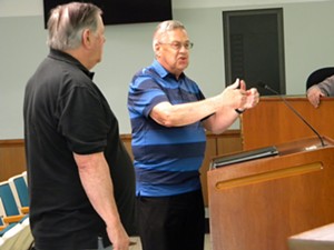
Residents of the Val-E-Vue subdivision near Abraham Lincoln Capital Airport say they are relieved the airport altered a plan to change about 92 acres from residential to industrial zoning.
The proposed rezoning for the land, which acts as a buffer between the subdivision to the south and the developed part of the airport, “could potentially ruin the neighborhood,” Val-E-Vue resident Gene Taylor said.
He and other subdivision residents spoke to the Springfield Plannin
Mark Hanna, executive director of the Springfield Airport Authority, told Illinois Times that the Val-E-Vue neighbors had no reason to be concerned about any imminent project at the property in question that might disrupt life in their neighborhood.
That’s because the 92 acres is designated as a “buffer area” beyond one of the airport’s runways, and will be preserved for that purpose in the long term, to protect and preserve the runway approach surfaces and provide airplanes extra space in case of emergencies, Hanna said. The 92-acre section has been used for agricultural purposes.
But to avoid delays in the rezoning process, airport officials agreed to remove the 92-acre tract from the airport’s overall request to rezone 1,089 acres of land owned by the airport from the current residential zoning classification to industrial. The 92 acres would remain zoned residential for now.
The commission voted 8-0 to support the proposal.
Taylor, 79, a retired executive director of the Illinois Educators Credit Union, moved with his wife, Cheri Taylor, 76, to Val-E-Vue, a 160-home neighborhood, in late 2019. Gene Taylor was chairperson of the Springfield Airport Authority Board in the early 1990s.
He said his neighbors in Val-E-Vue were puzzled and upset when a handful of them who live next to the 92 acres received a legally required notice of the impending rezoning request.
Industrial zoning would allow for a wide range of uses, including warehouses and chemical processing plants, and the notices put some neighbors in “panic mode,” Taylor said.
However, Hanna said no one from the neighborhood reached out to airport officials to inquire about the rezoning plan before the May 15 meeting. He described the overall rezoning request as “more or less of a housekeeping issue" and to maintain the airport authority's compliance with federal guidance for airports "to safeguard the surrounding air space and to avoid non-compatible land use on airport-owned properties."
The airport was founded in 1947 and over the years expanded into areas that were previously annexed into the city of Springfield, Hanna said. Newly annexed areas automatically were assigned a residential zoning classification by the city, and the zoning hadn’t been updated, he said.
The airport authority, a unit of local government, recently asked the city to rezone all of the airport-owned land to match the rest of the industrial-zoned property. That rezoning would help the authority in promoting property to developers for commercial use, Hanna said.
“We’re just preparing the property for long-term success,” he said. “You just never know what’s in the minds of site selectors or developers.”
There’s no such project pending that would require the rezoning to move forward, Hanna said.
The residential-zoned land to be rezoned industrial includes parts of airport runways, the control tower, state- and federally-operated offices and land east of the runways that airport officials want to develop for both aeronautical and non-aeronautical uses.
The staff of the Springfield-Sangamon County Regional Planning Commission recommended that the zoning commission and the City Council approve the entire rezoning request, including the 92 acres.
Located at Illinois Route 4 (Veterans Parkway) and Route 29 (J. David Jones Parkway), the airport covers 2,400 acres and is considered a “civil-military airport.”
In addition to providing commercial flights for the public, the airport is home to the 183rd Wing of the Illinois Air National Guard, as well as the Illinois Department of Transportation’s Division of Aeronautics and some businesses.
Because of the current location of runways, it’s “highly improbable” that the 92-acre buffer zone in question ever would be considered for development, Hanna said.
If that’s the case, Taylor questioned why rezoning of those acres would be needed. Airport officials should have done a better job of communicating with Val-E-Vue residents to avoid any unnecessary anxiety, he said.
Keeping the 92 acres as residential would give Val-E-Vue residents time to revive their dormant neighborhood association and be vigilant in case they want to oppose projects they don’t like in the future, Taylor said.
Hanna said airport officials made the request to properly zone property that never should be considered for residential development.
“We’re trying to be very truthful with how things are rezoned,” he said.

